Earth & Environmental Sciences Student.

I am an Earth and Environmental Sciences student interested in using Earth Observation and GIS to study climate change, glacier-related hazards, and environmental risks. My work focuses on applying geospatial methods to real-world problems, particularly in high mountain regions.
02 — International Mobility
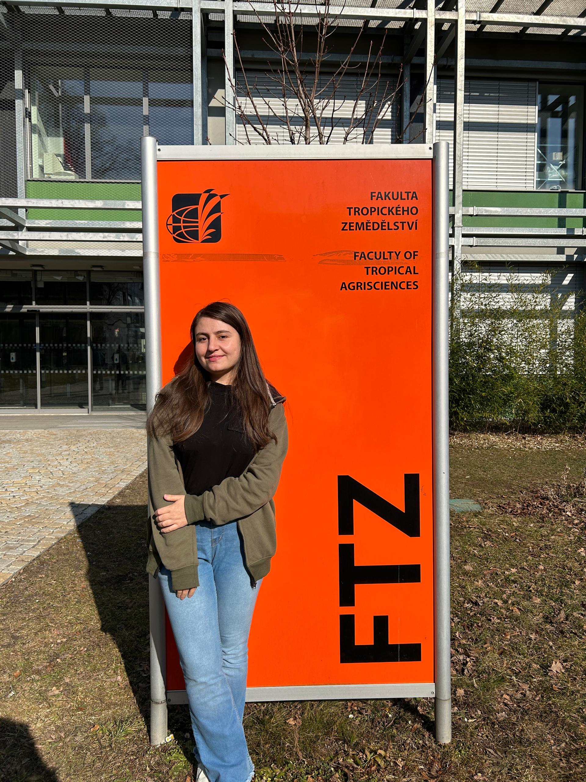
Erasmus+ Mobility Excellence
Institution: Czech University of Life Sciences
Location: Prague, Czech Republic
Awarded the prestigious Erasmus+ Excellence scholarship. This experience confirmed my ability to manage academic responsibilities in an international setting and adapt to new challenges.
Academic Experience
Personal Growth & Cultural Exchange
Relevance for Erasmus Mundus
2023 — 2024
Research Assistant
Research Assistant – Environmental Sciences
Under supervision of Prof. Mukesh Singh Boori
Worked on a research project focused on rice yield prediction in Bahawalpur, Pakistan, using remote sensing and crop phenology approaches. The work involved developing and implementing a structured methodology for satellite-based crop monitoring rather than producing final predictive outputs.
- • Conducted a detailed literature review on crop yield prediction using GIS, remote sensing, and phenological indicators.
- • Collected and preprocessed Sentinel-2 Level-2A imagery, focusing on cloud-free scenes representing key rice growth stages.
- • Delineated rice fields using official crop maps and grid-based spatial sampling.
- • Calculated and analyzed NDVI time-series across different phenological stages to study crop development patterns.
- • Designed a methodological framework for yield modelling using machine-learning approaches (MLR, Random Forest, SVM), including planned evaluation using RMSE and R².
Although the study was not completed to the modelling stage, this work strengthened my understanding of Earth Observation workflows, phenology-based analysis, and research design for agricultural applications.
June 2024 — Aug 2024
Climate Change Intern
Climate Change Intern
Aga Khan Agency for Habitat (AKAH) Dushanbe
Worked on climate change research, emissions assessment, and awareness activities supporting environmental planning and risk reduction initiatives. Contributed to the preparation of a research paper on Integrated Natural Resource Management (INRM) in mountain regions, focusing on climate change impacts, environmental degradation, and community vulnerability through literature review, data synthesis, and report writing.
- • Calculated CO₂ emissions from AKAH operations, including staff vehicle use, electricity consumption, and employee domestic and international travel, using activity-based data.
- • Collaborated with GIS and geology teams to support environmental risk mapping for local mountain communities.
- • Developed educational and awareness materials on basic climate change concepts, impacts, and adaptation, aimed at non-technical audiences.
- • Synthesized technical climate information into planning and strategy documents to support organizational decision-making.
Oct 2025 — Dec 2025
Nov 2024 — Dec 2024
Teaching Assistant
Physics Teaching Assistant
University of Central Asia
Worked as a teaching assistant for undergraduate physics courses, supporting both instructional and academic activities. Assisted the instructor in managing coursework and helping students better understand core physics concepts.
- • Checked quizzes, homework, and assignments, and maintained Excel-based grade records.
- • Held weekly office hours to support students, clarify course material, and address learning difficulties.
- • Assisted students with problem-solving and conceptual understanding during tutorials and lab-related sessions.
- • Coordinated closely with the course instructor to monitor student progress and identify areas for improvement.
- • Gained experience in academic communication, mentoring, and classroom support within a higher-education environment.
05 — Maps & Visualizations
Cartographic Gallery
Geospatial Outputs & Analysis
06 — Publications
A Review of Crop Yield Prediction Models based on Crop Phenology Using Satellite Imagery and Environmental Data
Zainab, A. (2024). In Proceedings of the X International Conference on Information Technology and Nanotechnology (ITNT). IEEE.
A Review of Eco-Environmental Changes and Their Impact on Ecology
Zainab, A. (Co-Author). (2024). In Proceedings of the X International Conference on Information Technology and Nanotechnology (ITNT). IEEE.
07 — Recognition & Credentials
Academic Honors
2021 — 2025
Dean's Honor List Award
University of Central Asia
- Academic Year 2024–25
- Academic Year 2023–24
- Academic Year 2021–22
Service & Leadership
June — July 2025
Deputy Camp Lead & Mentor
Recognized by the Aga Khan Education Board for excellence in coordinating daily operations and student well-being during the Bridge Program Summer Camp.
Professional Certifications
NASA ARSET | 2026
Fundamentals of Remote Sensing
Applied Remote Sensing Training Program
View CertificateEsri Training | 2025
Spatial Data Science
6-week MOOC: The New Frontier in Analytics
View CertificatePK Institute | 2021
Spoken English Certification
2-month intensive communication program
View Certificate08 — Toolkit
Technical Competence
Continuous LearningGIS & Remote Sensing
- ArcGIS Pro & QGIS
- Google Earth Engine
- EO Data Processing
- Sentinel-2, Landsat, DEM
Data Science
- Python (GeoPandas)
- R (Statistical Modeling)
- Machine Learning
- MLR, RF, SVM, Phenology
Research & Impact
- Climate Risk Mapping
- CO₂ Emissions Assessment
- Academic Coordination
- INRM, Disaster Mitigation
English, Urdu, Russian (Basics)
Mentorship, Technical Writing, Field Research
04 — Projects & Initiatives
Geospatial Analysis
GLOF Talidas Pakistan
A digital project documenting and analyzing the 22 August 2025 glacial lake outburst flood (GLOF) that transformed parts of Roushan village in Gilgit-Baltistan. This project uses satellite imagery, terrain analysis, field observations, and eyewitness accounts to reconstruct the event, visualize landscape change, and communicate hazard context.
Visit Live PortalAdvocacy & Awareness
Eco Influencers – Truth in Every Post
A web platform created to raise awareness about climate change and address common misconceptions in Pakistan. It uses accessible content, visual storytelling, and youth engagement to encourage informed understanding of climate science and promote positive environmental action.
Visit Live PortalFocus
Climate change myths vs facts
Approach
Science-based interactive content
Community Leadership
Bridge Camp – Community Education
Mentor → Co-Camp LeadAga Khan Education Service, Pakistan
Bridge Camp is a community education initiative supporting students from flood-affected areas who lack access to quality schooling. Each year, around 100–150 students participate in a two to three-week residential camp, where we voluntarily teach Cambridge-standard subjects, with a strong focus on English and core academic skills.
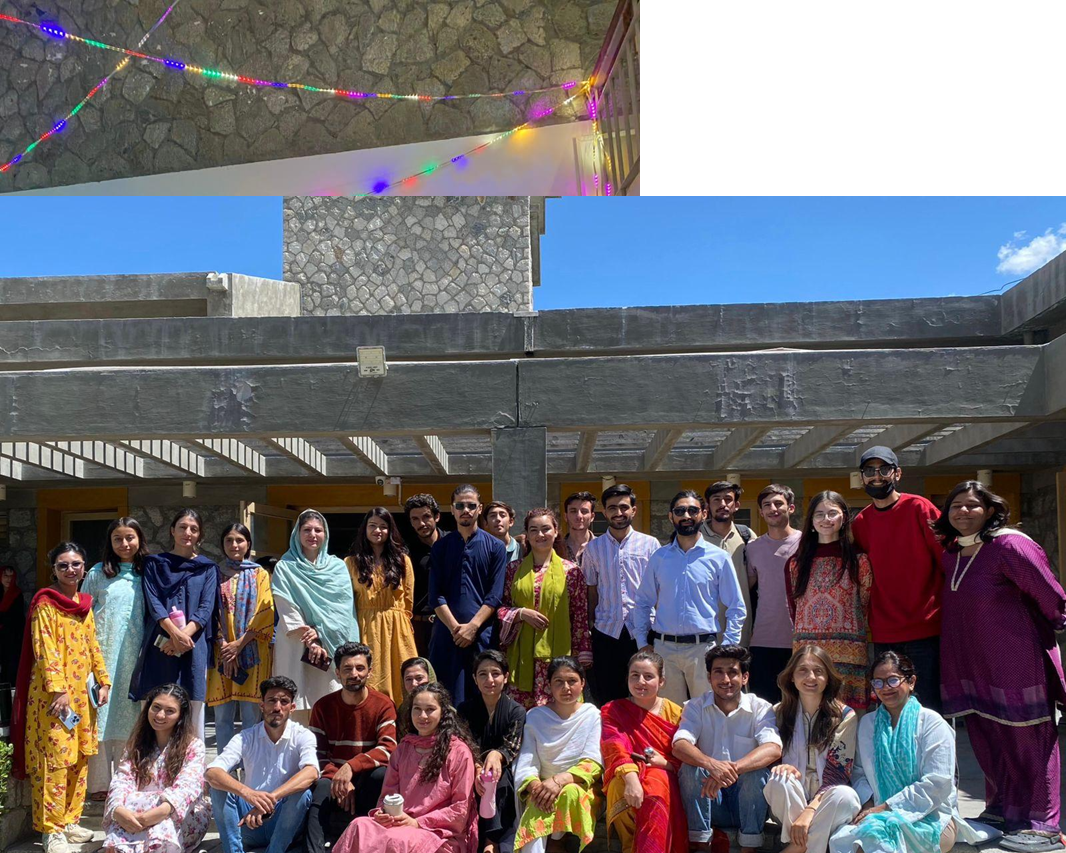
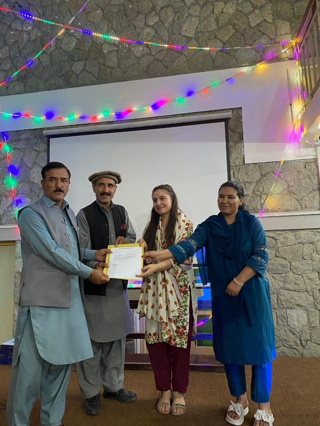
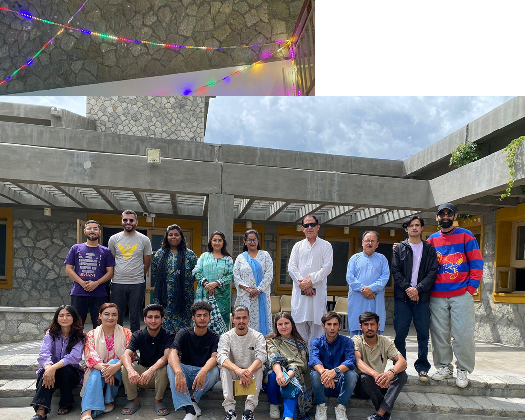
Academic Outcomes & Support
At the end of the camp, high-performing students are selected for full or partial fee scholarships and are supported in enrolling in English-medium schools and colleges. Through this initiative, I contributed to teaching, mentoring, coordination, and supporting equal access to education for students from vulnerable communities.